
Palm Springs Art Museum
- Location
- 101 Museum Drive
- Route relation
- Within walking distance of the Palm Canyon Drive corridor.
- Time effect
- Exterior viewing can be brief; entering galleries adds variable dwell time.
Downtown Palm Springs is most practical to explore on foot within the compact Palm Canyon Drive-centred core, not across the whole city. Use Palm Canyon Drive as the route spine; the published Walk of Stars loop provides a useful baseline of approximately 1 mile (about 1.6 km) and 30–45 minutes depending on stops, then add time for museums, shopping, food, photography, breaks or extra detours.

Downtown on-foot planner
Build the walk around one corridor, then change the route only when a stop, condition or time commitment justifies it.
Walking time is the movement baseline; total visit time = movement + stops + breaks.
In this guide, Downtown Palm Springs means the central walking corridor around Palm Canyon Drive and its practical connected detours. A destination that substantially increases walking distance, effort or route complexity belongs to a separate transport decision rather than being forced into the downtown walk.
Route practicality changes with the stops you choose, weather and heat, individual mobility needs, available time and—after dark—observable street conditions.
Palm Canyon Drive can serve as the route spine for a self-guided downtown walk, with the start point, end point and side trips adjusted to the stops you actually want to make.
A useful reference is the Palm Springs Bureau of Tourism's Walk of Stars route, which starts at Tahquitz Canyon Way and North Palm Canyon Drive and uses Palm Canyon Drive as its main north–south corridor. That specific loop is approximately 1 mile (about 1.6 km); it is a baseline, not the required distance for every downtown walk.
Use the route sequence below to minimise unnecessary backtracking, and shorten or rearrange it when heat, mobility needs, available time or selected stops make the original extent impractical.

The walkable downtown core is a practical planning boundary, not one universally fixed line. Palm Canyon Drive is the central reference corridor; street connection, added walking distance, route extent and detour effort determine whether a stop still functions as part of the compact downtown walk.
The diagram shows that route relationship for planning purposes rather than an official district boundary.
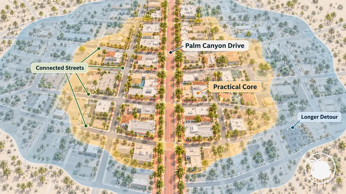
A borderline location therefore does not need an absolute inside-or-outside label. Its practical status depends on connection, added distance, detour effort and the walker's conditions.
Palm Canyon Drive is the downtown street corridor used in this walking route. Palm Canyon Trail is a separate hiking route in the Indian Canyons area; the similar names should not be treated as interchangeable destinations.
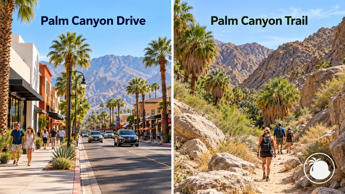
| Entity | Location context | Activity | Walking environment | Relevance to downtown route |
|---|---|---|---|---|
| Palm Canyon Drive | Downtown Palm Springs street corridor | Urban walking | Downtown street environment | Part of this walking route |
| Palm Canyon Trail | Palm Canyon in the Indian Canyons hiking area | Hiking | Desert canyon trail environment | Separate from this downtown route |
For a downtown-on-foot visit, use the full place name when choosing directions so a search for Palm Canyon does not send you into the separate hiking context.
Walkable downtown sights are stops that fit the Palm Canyon Drive-centred route without requiring a separate drive or a substantial extension beyond the corridor. Their route value comes from proximity and stop type: a streetscape feature can be experienced while moving, while a museum, shop or restaurant usually adds more dwell time.
The streetscape below illustrates how architecture, public art, shops, restaurants and cultural venues can form one walking experience without turning every sight into a separate excursion.
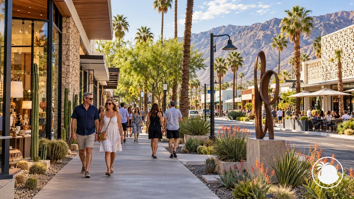
The practical distinction is between pass-by sights, which fit into movement between destinations, and dwell-time stops, which should be budgeted separately. Activities well outside the defined downtown core belong to the broader Palm Springs activity plan rather than this walking route.
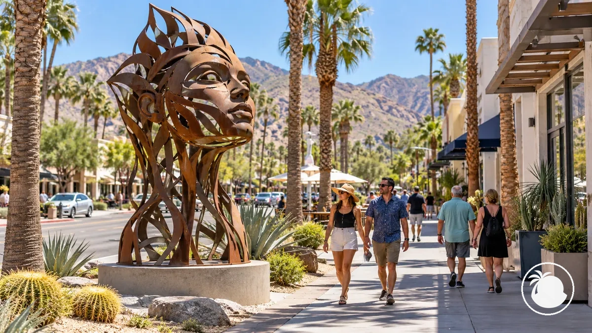
Public art works best in this itinerary as a route-adjacent visual stop: a sculpture, mural or other outdoor work can be encountered while walking when its current location sits on or close to the Palm Canyon Drive corridor.
On the corridor
Treat a currently confirmed artwork as a pass-by or short observation stop.
Connected side street
Use it as a small detour when the route out and back remains practical.
Temporary or event-based
Confirm the current location and timing before making it part of the route.
Because installations and event routes can change, do not assume that a named artwork remains a current downtown stop without checking its present location. The image illustrates the general relationship: art beside the pedestrian route can be part of the walk without becoming a separate citywide art itinerary.
Mid-century modern and Desert Modern architecture can be observed from public streets in Downtown Palm Springs without following a broader citywide architecture tour. Recognisable Desert Modern cues include clean lines, flat or butterfly rooflines, extensive glazing, indoor–outdoor connections and climate-responsive elements such as breeze blocks.
Downtown examples already identified in this guide include the Oasis Commercial Building and the Palm Springs Architecture and Design Center on Palm Canyon Drive. The Architecture and Design Center also uses a raised plinth and metal shade screens on its west façade.
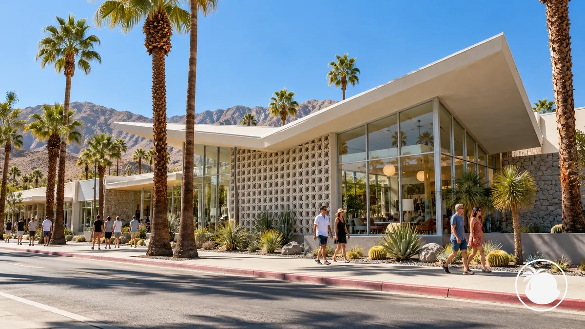
Use these street-visible features as observational cues rather than as a checklist that every building must satisfy:
Museums and cultural stops fit a downtown walk differently from pass-by sights because entering an exhibition adds dwell time. The practical choice is whether the stop is an exterior look or an indoor visit.
Palm Springs Art Museum
Architecture and Design Center
For a defined downtown route, separate movement time from dwell time. The Palm Springs Bureau of Tourism's approximately 1-mile (about 1.6 km) Walk of Stars loop is described as taking about 30–45 minutes depending on stops, which makes it a useful compact-route baseline rather than a fixed duration for exploring all of Downtown Palm Springs.
Museums, shopping, food and photography add stop time without necessarily adding much walking distance. Heat, mobility and comfort can also make breaks part of the schedule, so broader sightseeing time should be built from the route extent, pace and selected stops rather than a single universal number.
| Walking style | Route assumption | Typical stop pattern | Planning implication |
|---|---|---|---|
| Continuous corridor walk | Approximately 1-mile / 1.6-km published Walk of Stars loop | Few or brief stops | About 30–45 minutes, depending on stops |
| Light sightseeing | Compact downtown route with selected nearby sights | Brief architecture, public-art, shopping or photography stops | Plan beyond the 30–45-minute movement baseline according to the number and length of selected stops. |
| Stop-heavy exploration | Downtown route combined with longer cultural, shopping or food stops | Indoor visits, meals, extended browsing or planned breaks | Total visit time can substantially exceed walking time; treat dwell time and breaks as separate additions. |
Timing rule: start with the movement estimate for the route you actually plan to walk, then add the time needed for each intentional stop and any comfort breaks. Do not treat the compact-loop baseline as the total duration of a stop-heavy downtown visit.
Walking Downtown Palm Springs after dark requires a situational decision rather than a blanket safe-or-unsafe label. Palm Canyon Drive remains the route reference, but lighting, pedestrian activity, route familiarity, remaining distance, mobility and temporary street conditions can change whether continuing on foot is practical.
More active central blocks may have restaurants, entertainment venues and other businesses operating in the evening, but that does not guarantee identical conditions on every block. Reassess as the route moves towards quieter or less familiar edges.